WHY Weather
Land cover classification using satellite data and deep learning
Comprehensive land cover classification backed by remote sensing and deep learning by EOSDA for environmental monitoring, agricultural zoning, and strategic planning.
- Up to 90% accuracy across seven key surface cover classes with Sentinel-2 imagery
- Custom ML architecture trained with 10-band spectral imagery for high precision
- Actionable outputs, including raster land use classification maps, area stats, and optional reports
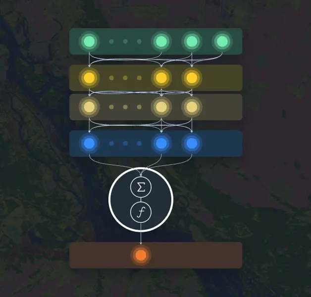
Approach and Methodology
Model: ML architecture consists of a custom fully connected regression model (FCRM) for each class.
Satellite data: The model for land cover classification utilizes Sentinel-2 L2A satellite images, applying 10 spectral bands.
Supported classes: 7 key surface cover classes, can be trained for additional classes.
Accuracy: up to 90%.
Limitations: Regions with high cloud cover, objects smaller than 30-50 meters in length/ width.
Expected project outputs and formats
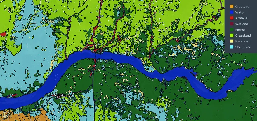
- Raster mask of classification with target classes cropped by target AOI (GeoTIFF): Bareland, Artificial, Water, Forest, Grassland, Wetland, Cropland.
- Aggregated statistics of areas per ground use class by admin boundaries of regions, districts, etc. (xlsx, csv), if required.
- Analytical report or results interpretation note, if required.