Carbon Solutions
Boost Carbon Credit Returns with Faster Project Monitoring and Verification.
Get precise stratification, digital MRV, SOC baselines and forecasts with WHY Carbon. It's a model-as-a-service powered by satellite data, AI/ML modeling, and domain expertise.
Carbon Assessment is Due for a Rethink
Why is SOC Assessment Still So Complicated?
- When managing carbon projects, soil carbon estimation remains one of the most resource-intensive hurdles.
At least one soil sample every 5-10 ha must be collected
- The sampling depth varies from 20 cm to 100 cm
Field sampling costs add up fast
- Travel, equipment, and trained labor make on-site sampling expensive at scale
Such assessment is done every five years
- And estimation cost per sample remains too high
This level of effort is unsustainable for projects that aim to scale.
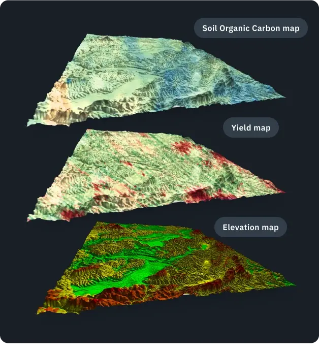
Soil Organic Carbon Modeling: Experience the Difference with Our Method
Our approach combines soil organic carbon (SOC) models with remote sensing to help carbon project developers, government entities, and verification bodies efficiently measure, estimate, and predict soil organic carbon. This method leverages the power of 140 predictors and allows for significantly reducing the number of expensive physical soil samples needed for verification. The extensive range of predictors, including satellite imagery, greatly improves the accuracy of SOC estimations. Join us in exploring how our model is contributing to the realm of measuring soil carbon while aiding in the pursuit of a sustainable future.
You can use our SOC model to:
- Save on soil sampling and increase profits from carbon credit generation.
- Use it as baseline for the carbon credit generation and creating a more positive footprint while increasing profit.
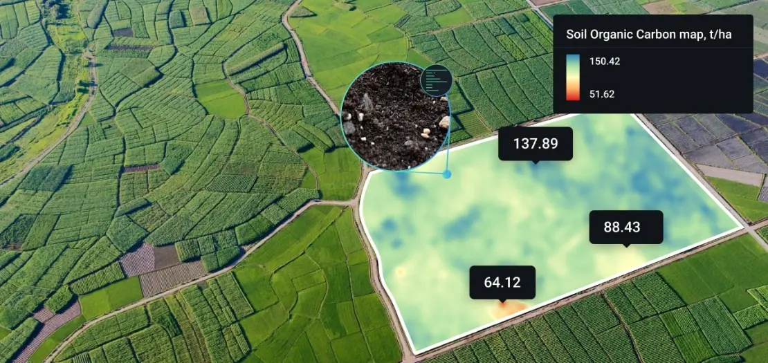
- Create accurate soil maps that illustrate its nutrient content, pH, etc.
- Optimize resource allocation (people, money, inputs, time) by upgrading farming activities to carbon sequestration MRV practices.